Fly From Anywhere — Advanced Remote Drone Operations Software Allows Pilots to Operate From Across the Street or Around the World
AUSTIN, Texas, March 29, 2022 (Newswire.com) - DroneSense (www.dronesense.com), makers of the most trusted and reliable public safety drone platform, today announced the launch of DroneSense Remote (DSR) for first responders—a game-changing drone remote control capability that integrates seamlessly into the DroneSense industry-standard software platform and allows pilots the ability to operate drones with manual and fully-automated flights controlled from anywhere in the world.
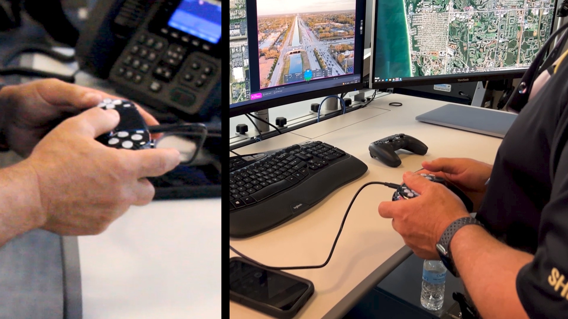
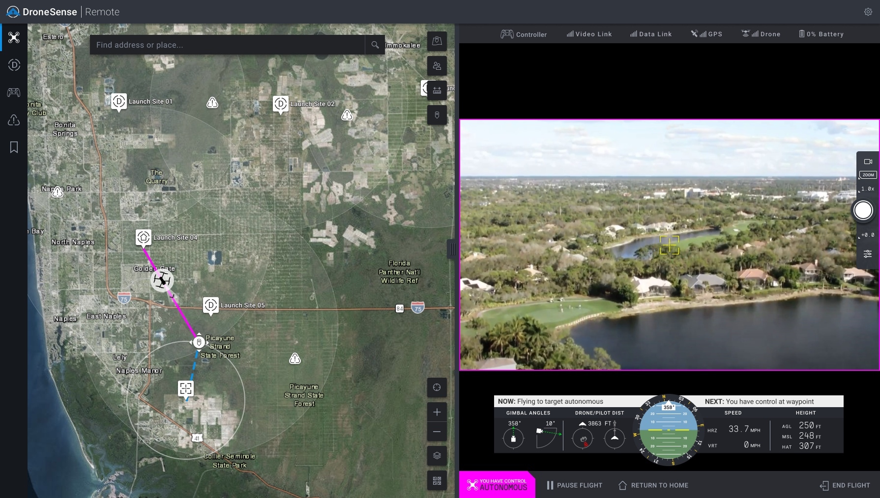
DSR provides pilots effortless control with help from the world's most intuitive gaming controller and near-zero latency. With DSR, the flying experience is so precise that even indoor missions can be flown from locations thousands of miles away. Using built-in preflight checks, customizable geofences, continuous network integrity monitoring, and emergency landing sites, DSR creates the industry's safest approach for demanding environments. DSR even accounts for elevated takeoff locations to ensure strict adherence to designated flight altitudes.
"We're thrilled to offer first responders the most advanced drone flying experience designed specifically for ever-changing missions and extreme environments," said Chris Eyhorn, CEO of DroneSense. "DroneSense Remote gives pilots more control, allows on-scene resources to focus on the mission, and provides an entirely new layer of safety."
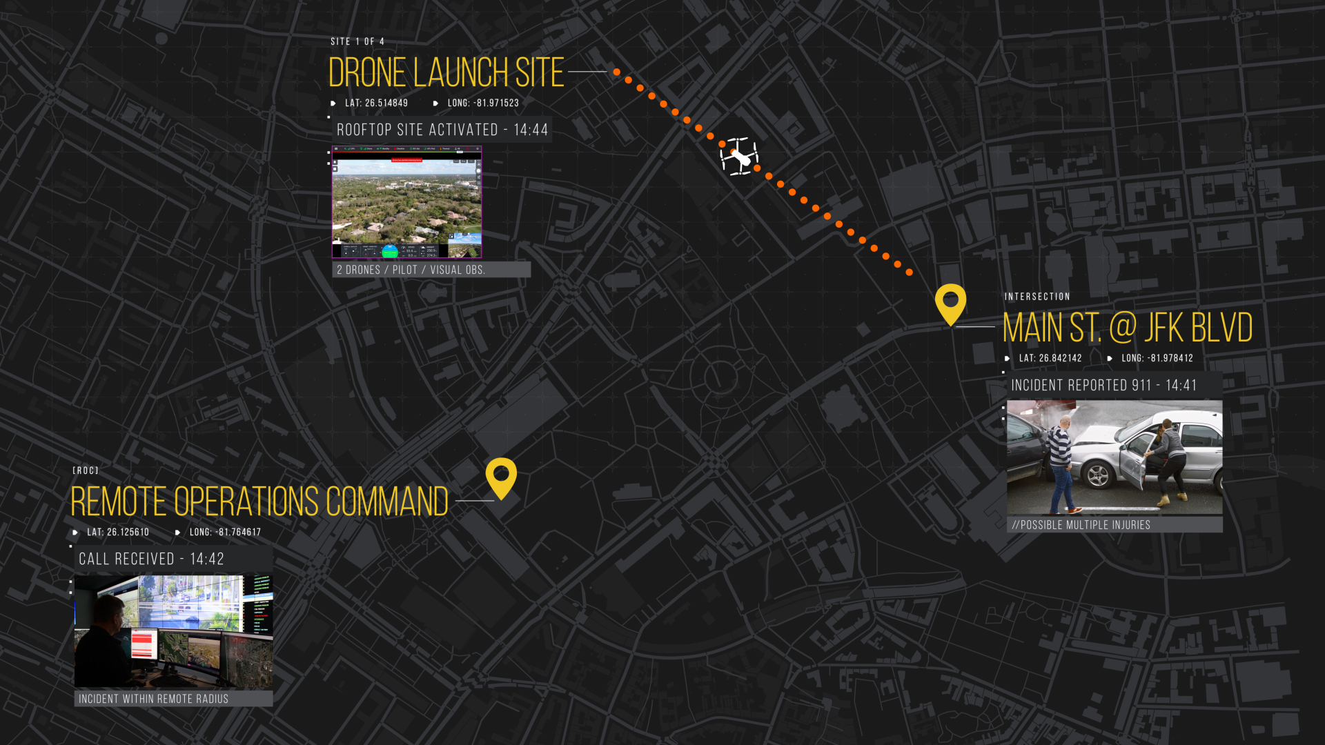
In collaboration with Collier County Sheriff's Office, Collier County, FL, DroneSense has worked to address key challenges in public safety remote drone operations. In addition to educating DroneSense about the real-world problems faced by their first responders, Collier County has inspired, reviewed, and tested each phase of the DSR development. As a result, DroneSense has created a more intuitive way to fly drones remotely, offer fully integrated fleet management and maintenance systems, provide text and email notifications for drone launch events, and advanced GIS integration.
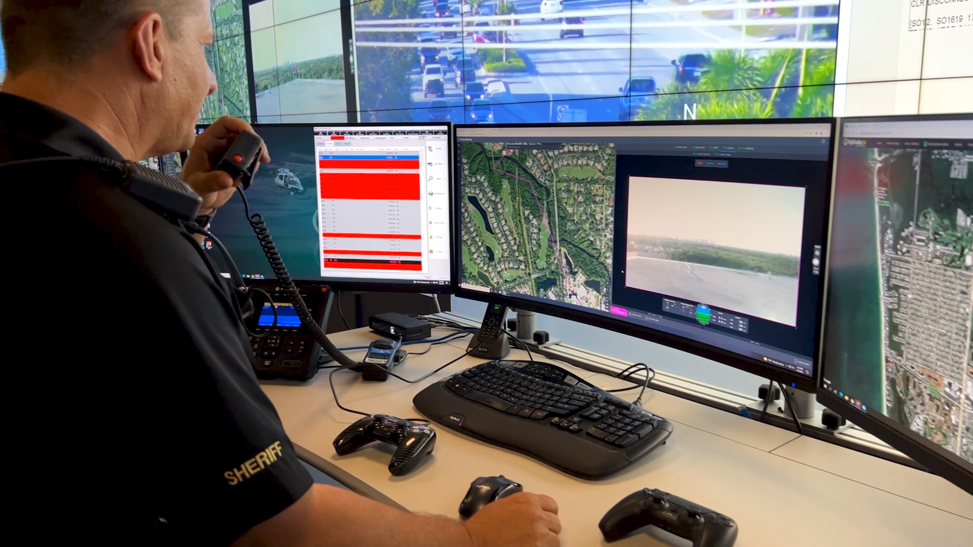
"This new capability from DroneSense fits well with our Aerial First Responder program and this innovative remote technology instantly adds a new tool for our deputies to complete their missions and keep our community safe," said Kevin J. Rambosk, Collier County Sheriff. "Each time we deploy our drones through DroneSense, we do so knowing our community members and our deputies are safer."
DSR gives agencies of all sizes extreme flexibility in how and when they fly. Options include flying Drone as First Responder (DFR) missions under an FAA waiver or remaining within visual line of sight and using existing COA or Part 107 authorities. DSR's innovative user-friendly site profiles allow pilots to create fully customizable flight restrictions for fixed and dynamic operations.
Using DSR, the remote operator can launch a drone in almost any format, including street address, intersections, GPS coordinates, or by simply clicking a location on a map using a web browser. The drone flies to the incident site quickly and safely using onboard sensors and geo fences while seamlessly streaming live video and flight data into the comprehensive situational awareness platform. DSR takes safety further than ever by providing information such as estimated time en route, how long the drone can remain onsite, and displaying designated emergency landing sites in a clean, map-driven experience.
DSR is available for the DroneSense and Axon Air powered by DroneSense platforms. DSR currently supports flights using DJI M300 and Mavic aircraft and is in the process of integrating additional aircraft models already supported by the DroneSense software platform.
To learn more about DSR, please visit www.dronesense.com/remote.
Source: DroneSense
Share: